Fixed Mooring Buoys
Moored buoys are anchored at fixed locations and regularly collect observations from many different atmospheric and oceanographic sensors. The long term recordings collected by the fixed stations can provide evidence on the ocean state and ocean variability, allow a better understanding on the several processes that take place in the marine environment, support the calibration and the verification of the marine and weather forecasting systems but also to enhance the maritime safety and the efficient planning of marine infrastructures.
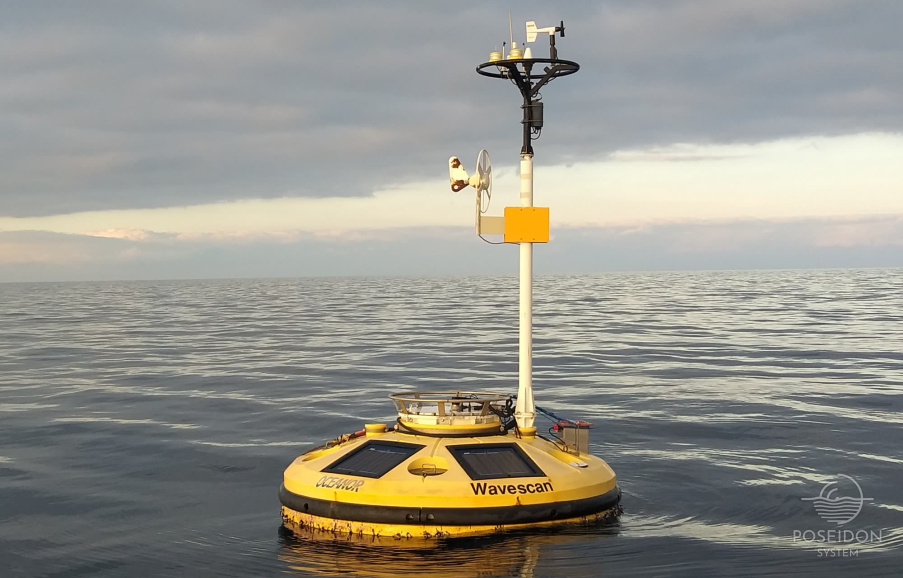
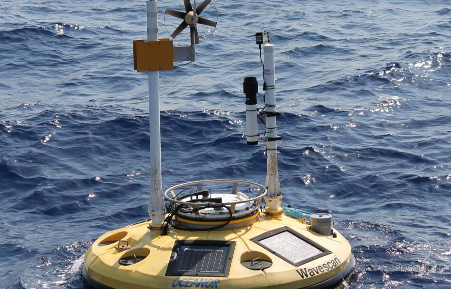
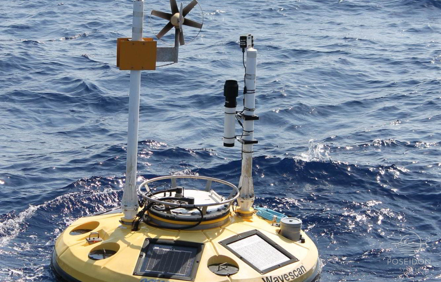
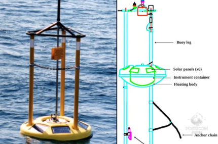
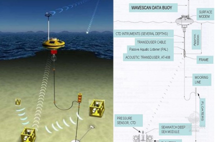
The Poseidon system operates a network of fixed measuring floats, which are moored at various locations in the Aegean and Ionian seas and consist of Seawatch platforms (Figure 1a) designed for deployments in marine areas shallower than 300m and the Wavescan platforms (Figure 1b) which can host multiparameter observatories and are designed for deep basins. The latter platform types can incorporate an inductive coupling mooring cable so that the instruments can support the data transfer through these cables in order to be available in real time even at depths greater than 1000m. Both types of floats are manufactured in Norway by Fugro Oceanor. The data, after being sent by the stations, are collected at POSEIDON operational center where they are automatically processed, quality controlled, stored to the system’s database and then released to the European Marine Databanks (CMEMS, EMODnet).
The buoys consist of 5 parts which are presented below:
The buoy support structure is made of marine aluminum and stainless steel. Aluminum is used in the construction of the main frame which allows for the attachment of floats and provides an airtight section (container) for mounting all necessary electrical and electronic equipment. The aluminum mast also provides suitable locations for the safe placement of the following devices at 3.5 meters above sea level:
- Flashlights
- Inmarsat C antenna
- GSM antenna
- UHF antenna
- GPS antenna
- Air temperature sensor
- Wind speed and direction sensor
- Lightning rod
- Wind energy generator
- Iridium tracker modem
- Humidity measurement sensor
- Precipitation measurement sensor
- Solar radiation measuring sensor
Above and below the float (up to 3 meters) there are also suitable positions for the safe placement of measuring instruments. The part of the sensors below sea level can be extended up to 1000 m deep using an inductive mooring cable, which forms part of the mooring line.
The floats of the buoys are structured in a way that allows them to be repaired or changed without the need to disassemble the bearing structure. They are made of polypropylene and provide the necessary buoyancy to the buoy. Specifically, for the Seawatch type, the top of the floats is divided into an additional 3 parts. The floats provide special paths for securely mounting the external wiring connecting the metering devices and the solar panel cable for charging the batteries. Solar panels are different between the two types. The Seawatch type has 4 solar panels rated at 10 Watt maximum and the Wavescan four at 20 Watt. The solar panels are mounted in suitable sockets on the floats tilting towards the horizon.
This section serves as an insulated waterproof compartment containing the batteries to power the electronic devices inside. Such electronic devices are the telemetry system, the data recording system and certain measuring instruments such as atmospheric pressure and wave. The lid of this watertight section has all the sockets necessary for mounting the external cables that provide power and data connection to the instruments. The batteries are special type lead batteries which have an exhaust system to remove the hydrogen produced during the charge cycle, thereby minimizing the possibility of an explosive mixture of gases inside this closed compartment.
A range of atmospheric and oceanographic instruments can be attached to the mooring station. Examples include:
Above sea level (at 3.5 m height)
- Atmospheric temperature measurement instrument
- Wind speed and direction instrument
- External air pressure instrument
- Humidity measuring instrument
- Precipitation measuring instrument
- Radiation measuring instrument
At the surface of the sea (inside the air tight container)
- Wave measurement instrument
- Magnetic compass
- Internal air pressure measuring instrument
- PMU (Power Management Unit)
- GENI (mini computer, data logger)
- Inmarsat C transceiver
- UHF modem
- GPS receiver
Below the sea surface
- Water current speed and direction measuring instrument
- Water temperature and conductivity measuring instrument
- Irradiance measuring instrument
- Dissolved oxygen measuring instrument
- Turbidity and chlorophyll-A measuring instruments
The buoys are held at place with a single point anchorage system. The mooring line from the float to the bottom includes a chain, rope or inductive cable, rope, ballast release system and ballast anchorage. The use of the inductive cable allows many inductive transmission capable instruments to be attached along at different depths up to 1000 meters. The anchors weight is about 800 Kg for the Seawatch buoys and 1200 Kg for the Wavescan buoys.
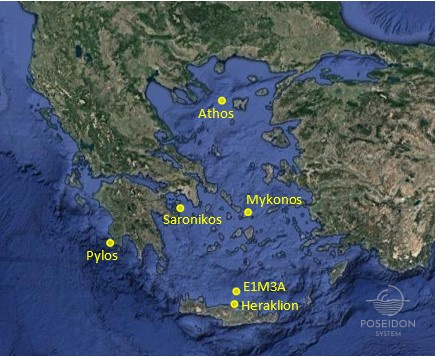
It is located in the northern Aegean basin, between the Athos peninsula and the island of Limnos. It belongs to the family of Wavescan buoys and has been part of the POSEIDON network since 2000, monitoring the physical and biochemical properties of the water column up to 100 m deep. It carries sensors for measuring the surface marine and atmospheric conditions such as the air temperature, the wind speed and direction, the waves and the currents, while CTD and biochemical data are also collecting for the 100m of the water column. This mooring position was chosen to monitor the signal of the Black Sea Waters (BSW) that enter the Aegean Sea through the Dardanelles straits and it is known to have a significant impact to the dynamics and hydrology of the North Aegean.
It is located in the Saronic Gulf and it was the very first station of the POSEIDON mooring network. The Saronic Gulf is an area which lies in front of the Athens metropolitan area, it is easily accessible for field research and it is also an area where systematic monitoring programs are in place for more than two decades. This station is equipped with sensors for the continuous recording of atmospheric and surface marine physical parameters while sensor based biochemical data have also been recorded for specific time periods in the framework of relevant research projects.
It is located close to the northeast part of Mykonos Island and after a five years break it was redeployed in April 2017 anchored at a depth of 130 m. It is a Seawatch type buoy equipped with temperature, salinity, surface currents and wave measuring instruments, while it carries also sensors for recording atmospheric parameters, such as the air temperature and the wind speed and direction. This area has been selected due to the seasonal variability of the surface circulation pattern but also to record the wind pattern that dominates the area. The winds blowing over Mykonos are characterized by strong seasonality, reaching their maximum values during the summer months.
It is a multidisciplinary observatory mooring located in the cross road of Adriatic and Eastern Mediterranean basins. The Pylos site in the SE Ionian is a crossroad where intermediate and deep water masses originated in Levantine, Adriatic and Aegean meet. It is especially on the pathway of the Aegean Sea dense water that travels to the north along the western coast of Greece. Furthermore, it is a very geologically active area with lots of earthquakes and landslides as well as a potential source of Tsunamis that might affect the Eastern Mediterranean Sea. The fixed station consists of a surface Wavescan type buoy equipped with sensors for meteorological, waves and surface oceanographic parameters (Temperature, Salinity, Current) as well as a suite of CTD sensors attached on the inductive mooring line (20, 50, 75, 100, 250, 400, 600, 1000m), while in the first 100m additional biochemical parameters (Chl-A, DO, turbidity) are also recorded.
The station is located 24 nautical miles north of the island of Crete anchored at a depth of 1,400 meters and it has been part of the POSEIDON network since 2007. The Cretan Sea is an area of intermediate and/or deep-water formation dominated by multiple scale circulation patterns and intense mesoscale variability. Such areas of water formation are key locations for monitoring of the Mediterranean biochemical functioning. The wintertime convective mixing of the water column and the exchanges of water and mass (diluted, suspended or near-bed) with the adjacent Levantine and Ionian Seas through the straits of the Cretan Arc, make the Cretan Sea the poorer in nutrients and the richer in oxygen among the principal basins of the Mediterranean Sea. The mooring is currently the most developed physical-biogeochemical observing site of the POSEIDON system collecting CTD data down to 1000m, Chl-A, DO and turbidity data for the first 100m of the water column while the recent addition of surface pH and pCO2 sensors further expanded the biochemical component of the station.
During 2016, the Cretan Sea observatory was expanded with a second fixed platform, the Heraklion Coastal Buoy (HCB). This Seawatch buoy measures surface marine and atmospheric parameters (water temperature and salinity, currents, waves, air temperature, wind speed and direction) and coupled with the existing infrastructures already present (E1M3A station, Ferrybox, Glider missions, repeated cruises, Bio-Argos) in the area, opens possibilities to study the interaction of coastal with open sea processes (e.g. wave dynamics, exchanges of matter, extreme events spatial extend).
The oceanographic buoys constitute the backbone of the POSEIDON system and they are linked to the Mediterranean fixed stations network through the continuous contribution of the physical and biochemical recordings that take place in the Greek Seas.


