Argo Floats
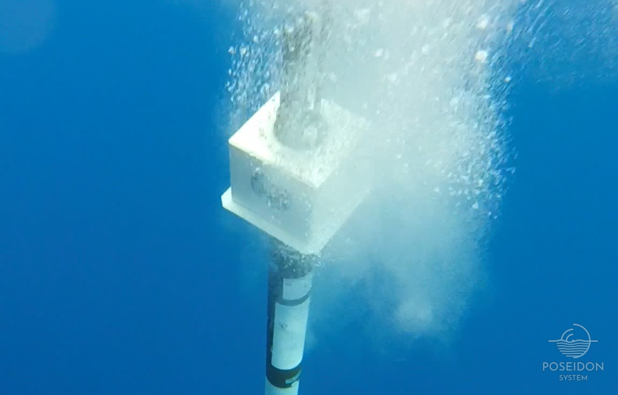
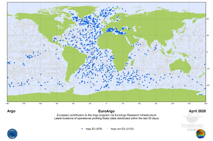
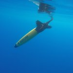
The Argo Floats are autonomous free-drifting profiling floats that descend to a target depth, drift for a predefined time period, and then descend again to a target profile depth to start the physical and biogeochemical parameters’ profile. During the last decades the Argo network has become an integral and necessary component towards ocean monitoring which is crucial for the science of climate dynamics and climate change. Today the global Argo Network (www.argo.net) consists of approximately 4,000 floats and has become the first-ever global, in-situ ocean-observing network in the history of oceanography.
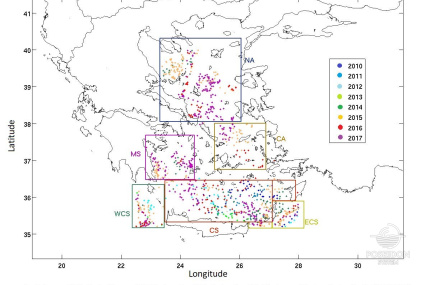
Since the last decade, the expansion of the Argo floats in marginal seas has significantly enriched the oceanographic monitoring and produced enhanced datasets. Such evolution is the outcome of the combined activities of Euro-Argo Research Infrastructure (www.euro-argo.eu) and the National Argo initiatives. Since 2014, Greece has become a member of Euro-Argo ERIC and therefore fully aligned with the key objectives of the European infrastructure. In the time period 2010 - 2019 more than 28 floats have been deployed in the Eastern Mediterranean basin from the Greek-Argo infrastructure (www.greekargo.gr), that is part of the POSEIDON Operational Monitoring System, collecting a large number of temperature, salinity, and dissolved oxygen profiles.
The majority of floats are configured to drift at 350 m depth and then descend to a maximal profile depth of 1000 m at continuous 5-days cycles following the recommendations of MedArgo (http://nettuno.ogs.trieste.it/sire/medargo). More specifically, the drifting depth is set near the depth of the LIW core, while the profile depth is set as a representative depth of the basin in which the bathymetry varies from shallow to deep sub-basins. The floats are in general configured to slightly ascend and carry on drifting in cases of grounding in order to achieve a continuous drift and a better representation of water movement even in shallow areas. The vertical resolution in the mission parameters configuration is set so as the floats would operate a vertical 2 m sampling from the surface to 100 m and a 10 m sampling for the layer between 100 and 1000 m. In that way, a higher frequency sampling is achieved in the upper part of the water column allowing a more detailed recording of the thermocline variability and the MLD. Finally, the 5-days cycle length allows robust and useful estimates of currents at the parking depth, as longer cycles are not able to represent the circulation in the vicinity of the intricate coastlines of sub-basins such as the Aegean Sea.
Being an important monitoring component of the POSEIDON network, the Greek Argo activities are coordinated by the Institute of Oceanography of the Hellenic Centre for Marine Research (HCMR), being also a part of the Hellenic Integrated Marine and Inland Water Observing, Forecasting and Offshore Technology System (HIMIOFOTS). More than 2500 profiles have been so far acquired in sub-basins of the Aegean, Ionian, Libyan, and Levantine Seas that were previously under-sampled. Along with the float deployments, the POSEIDON team has been exploiting Argo data for operational forecasting as well as for research studies and applications. Furthermore, the Greek Argo team participates in Argo related research projects, contributes to the European strategy of oceanographic monitoring, provides deployment opportunities and synergies with other RIs, and promotes operational oceanographic activities through educational, outreach and communication initiatives at national level.


