
Record-breaking waves across the Ionian Sea and the southern Italian coasts due to storm Harry
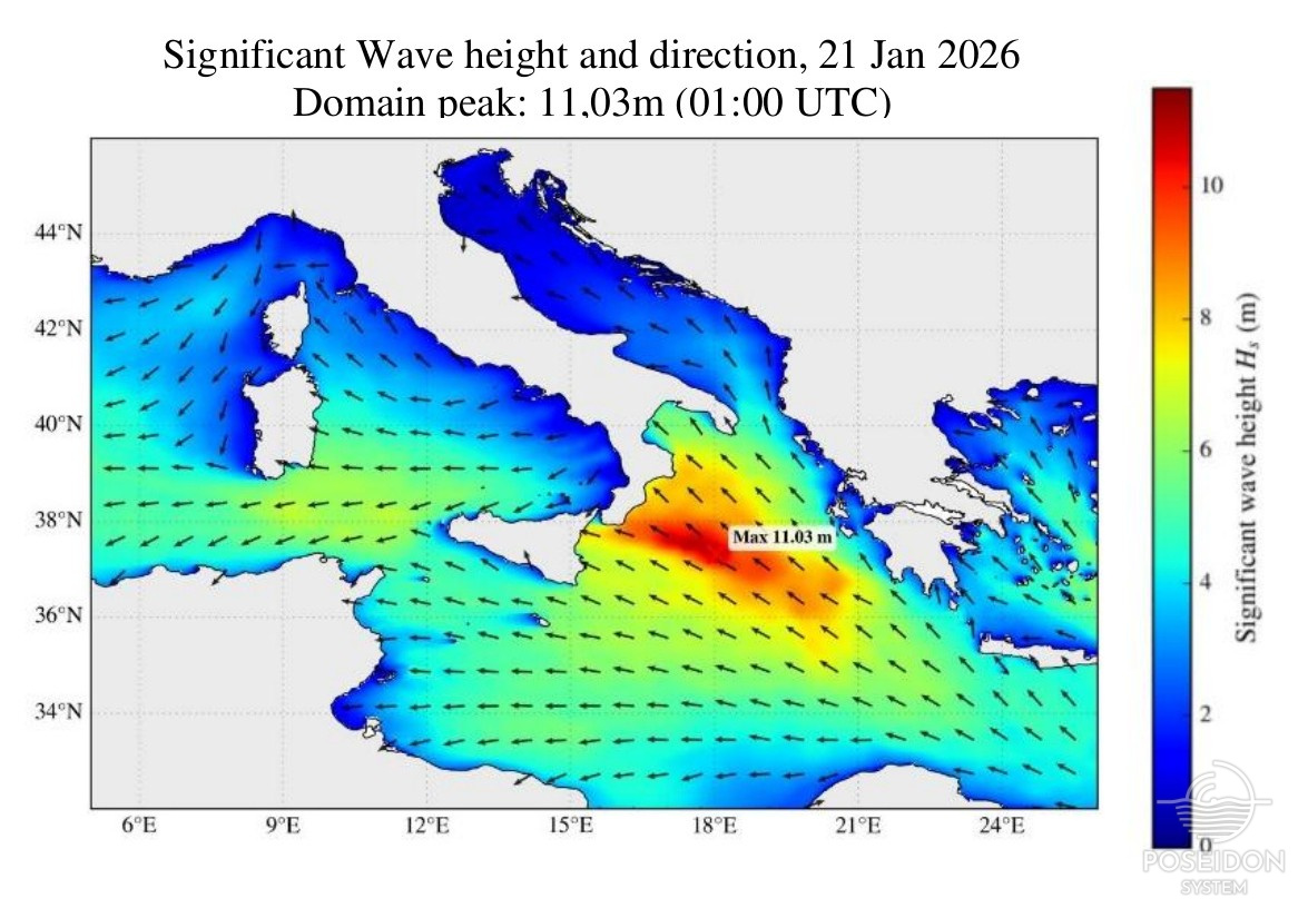
During 20–21 January 2026, Storm Harry generated exceptionally severe sea states across the Central Mediterranean, with the most extreme conditions concentrated over the central–southern Ionian Sea, south of Italy and west of Greece. Wave forecasts from the Copernicus Marine Service (Med-MFC), supported by multi-mission satellite altimeter observations assimilated by the model, consistently indicated very high to extreme seas, with significant wave heights (Hs) exceeding 10 m. Significant wave heights reached maximum values of 10.36 m on 20 January (17:00 UTC) and further increased to 11.03 m on 21 January (01:00 UTC). In both cases, the maxima were located offshore in the central Ionian Sea (around 36.4–37.3°N, 17.5–18.0°E), rather than directly along the coast. In addition to significant wave height, maximum crest–trough wave heights (VCMX) reached exceptionally high values, peaking at 15.55 m on 20 January and 16.57 m on 21 January at the same locations and times as the Hs maxima. These values highlight the severity of individual waves during the storm peak.
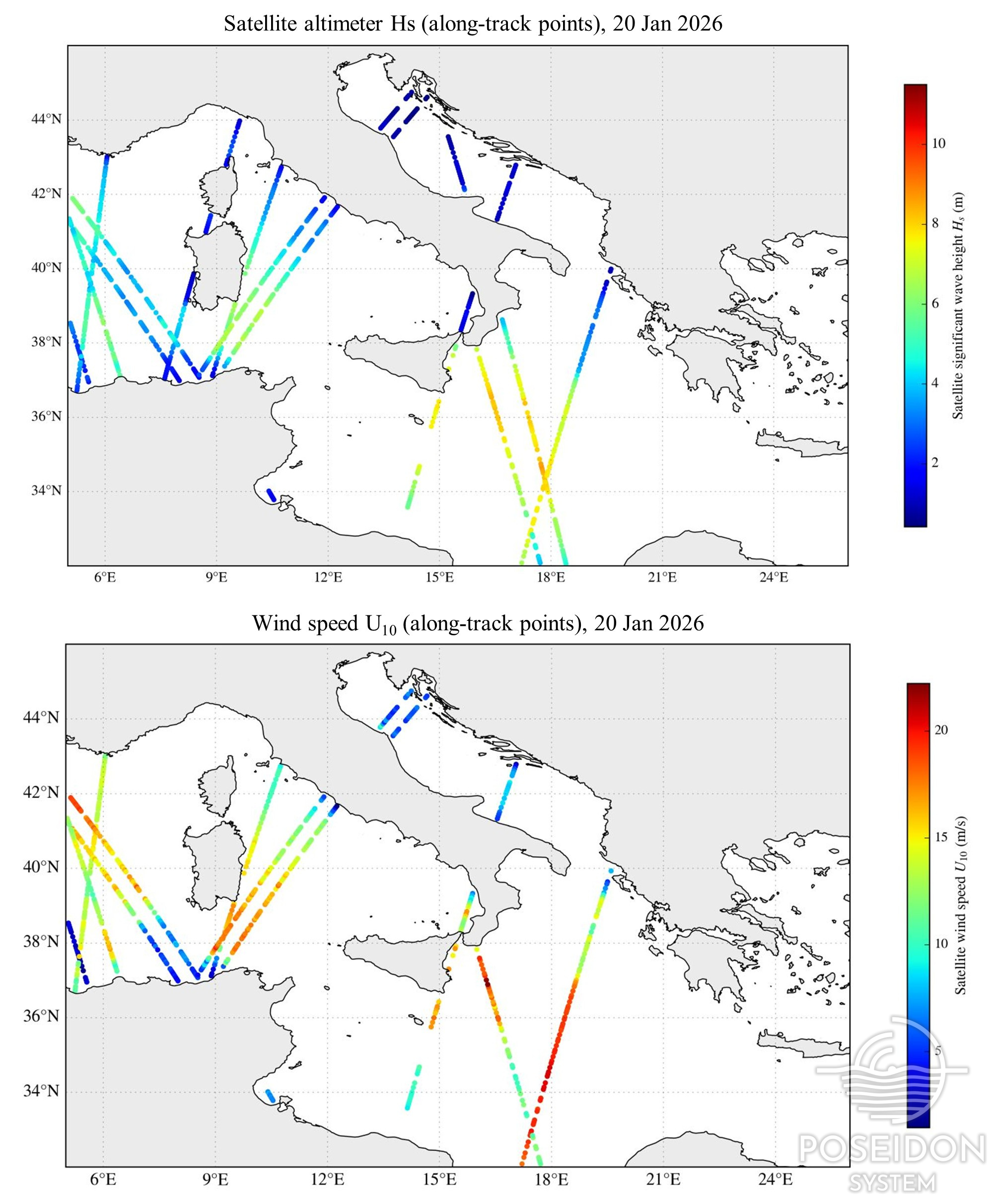
Although the highest waves occurred offshore, very high wave heights were also observed along the eastern and southern coasts of Italy and around Sicily, where storm impacts and coastal damage were reported. The spatial distribution of wave heights shows that these coastal regions were exposed to severe to very severe sea states during the event. Independent satellite altimeter passes (from Sentinel-3a, Sentinel-3b, Sentinel-6, Jason-3, CryoSat-2, CFOSAT and Saral/AltiKa) captured both large significant wave heights and strong surface winds. Along-track estimates with 10-m wind speed (U₁₀) reached locally up to 22.24 m/s over the Ionian Sea, noting that higher values may have occurred outside the satellite ground tracks. The storm was characterised by persistent easterly wind directions, which enhanced wave growth through a long effective fetch across the Ionian basin, contributing to the development of exceptionally large waves.
The close agreement between the forecasting model and satellite measurements confirms both the severity of Storm Harry and the robustness of Copernicus Marine modelling and monitoring systems in capturing extreme marine conditions in the Mediterranean Sea which is a hotspot for climate change. The event generated dangerous to very dangerous conditions for maritime activities, particularly over exposed offshore areas of the Ionian Sea and along the southern and eastern Italian coasts during the storm peak.

Data sources
Korres, G., Oikonomou, C., Denaxa, D., & Sotiropoulou, M. (2023). Mediterranean Sea Waves Analysis and Forecast (Copernicus Marine Service MED-Waves, MEDWAΜ4 system) (Version 1) [Data set]. Copernicus Marine Service (CMS).
https://doi.org/10.25423/CMCC/MEDSEA_ANALYSISFORECAST_WAV_006_017_MEDWAM4
Copernicus Marine Service (CMEMS), Global Ocean Level-3 Significant Wave Height from Near-Real-Time Satellite Measurements. https://doi.org/10.48670/moi-00179 (accessed 22 January 2026).